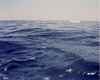
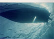
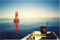
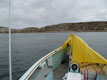
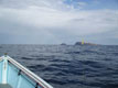
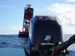
Cortes Bank is a dangerously shallow chain of underwater mountains in the Pacific Ocean, about 115 miles (188 kilometers) west of Point Loma San Diego, USA, and about 50 miles (82 kilometers) south-west of San Clemente Island. The chain of peaks is about 18 miles (30 kilometers) long and they rise from the ocean floor from about 1/2 mile (about 1 km) down. Some of the peaks come to just 3 to 6 feet (1-2 m) below the surface at Bishop Rock, depending on the tides. The peaks are a hazard to shipping, but help create a noted big-wave surfing spot. West of Tijuana, Mexico, and south of Port Hueneme, California. Bishop Rock is one of the jagged peaks in the underwater mountain chain that rises to within 3 to 6 feet (1-2 m) of the surface and is marked by a nearby warning buoy. It was named for the clipper ship Stillwell S. Bishop that struck the rock in 1855 (and with a patched hull made it to San Francisco). Nine Fathom spot is about 4.5 miles (7 kilometers) northwest of Bishop Rock and also rises to about 98 feet (30 m) below the surface. Both are noted scuba diving locations featuring clear water and abundant sea life. In 1969 a group of promoters bought the World War II surplus troop ship SS Jalisco, renamed her USS Abalonia, and sailed to the bank, intending to sink her in shallow water to form a tax-free island nation and shellfish processing plant. But during that sinking rough seas broke a mooring line and pushed her into deeper water. Another company planned to build a platform on the bank and form a nation called Taluga, but the US government declared that the bank, as part of the continental shelf, was US territory. The wreck of the Abalonia today lies in three pieces under about 40 feet (12 m) of water and is another dive spot. On 2 November 1985 the nuclear-powered aircraft carrier USS Enterprise (CVN-65) struck the Cortes Bank reef about one mile east of Bishop Rock during exercises, putting a 40-foot (12 m) gash in her outer hull on the port (left) side, and damaged 3 of 4 propellers. She continued operations then went into dry dock at Hunter's Point Shipyard in San Francisco for repairs.